Completed

AULIS - Automated landslides inventory based on very high spatial resolution images

The main objective of this research project is to give a major contribution to the inventory of landslides with a degree of completeness never achieved before. This objective was accomplished through the development of an automated methodology that uses a combination of remotely sensed and elevation data of very high resolution. The testing and validation of the methodology was mainly performed on Funchal and Ribeira Brava basins in Madeira Island using multitemporal satellite and aerial imagery together with elevation and field data.

GHAMA - Assessment of the use of Ground Source Heat Pumps (GSHP) in heating and climatization of the Military Academy (Portugal): Amadora Quartering case study

This Project was focused on the investigation of existing surface installations and their ability to withstand a geothermal intervention, more precisely a building that functions as a dormitory in the Amadora Quartering of Academia Militar (Portugal), evaluating the thermal loads that can be replaced by geothermal energy. Of greater importance was the feasibility study of the most suitable scenarios, considered, for a conceptual phase of a pilot geothermal installation.

ORVITER

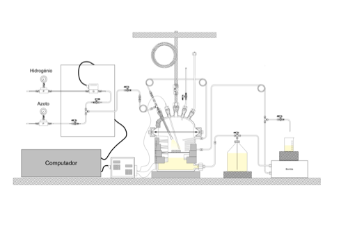
Continental active serpentinization of ultramafic rocks is today recognized as a key process triggering a sequence of phenomena involving the passage from inorganic, to organic and metabolic reactions. These may have a role in the origin of life, and may explain the occurrence of abiotic hydrocarbons on Earth and other planets. Production of hyperalkaline waters and abiotic methane (CH4) are two critical steps in this sequence. They were described independently by specific hydrogeological and geochemical models.

FAME - Flexible and Mobile Economic Processing Technologies

FAME is an active Research and Innovation project to develop economically viable, flexible and mobile combinations of technology to exploit European ore deposits that are often relatively small in tonnage terms.  This project specifically addresses three different primary ore types: skarn, greisen and pegmatite.  These ores carry significant potential for the extraction of Critical Raw Materials.  Although these ore types are complex mineralogically and have variable metal grades they are of great strategic significance in relation t

FINDER

Project FINDER aims to identify and characterize the active trace of the Lower Tagus Valley (LTV) fault zone using a revolutionary and relatively new technique: airborne LiDAR (Light Detection And Ranging). In the first phase of this project, high-resolution LiDAR data will be used to determine the extent, geometry, and segmentation behavior of the LTV fault zone.